Road Network Operations
& Intelligent Transport Systems
A guide for practitioners!

Road Network Operations
& Intelligent Transport Systems
A guide for practitioners!
Many electronic payment systems, such as toll collection, off-street parking and port access for HGVs are trigged by the presence of the vehicle itself. Some technologies for vehicle presence detection are also able to perform other vehicle-specific measurements. Examples are in-ground inductive loops and cameras with image processing software, both capable of classifying a vehicle. Sensors that depend on their deformation to sense a vehicle include treadles, capacitive sensors and piezo sensors, each of these formed into strips that are embedded into the road surface (See Roadway Sensors).
The configuration of non-contact, above-ground sensors depend on the desired location; laser scanners, radar and cameras may be used above traffic lanes whilst side-mounted optical light curtains and laser scanners are suitable for toll lanes. All of these rely on additional processing to properly interpret approaching vehicles and to reject objects such as pedestrians, animals and shadows and reduce the impact of rain.
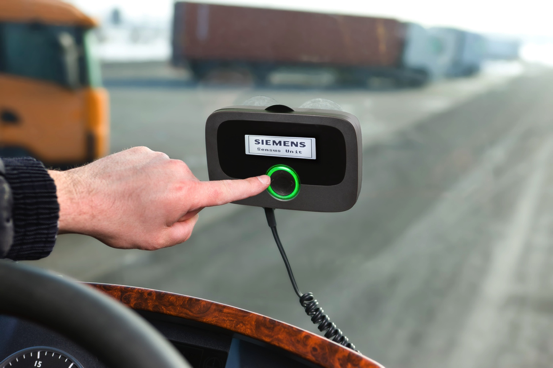
Vehicles may be subject to regulations that depend on their location on the road network. For example, a national road user charging policy may be based on the distance that a vehicle has travelled, where charges also depend on the type of vehicle and road. (See Electronic Payment) To do this, a vehicle may be equipped with an On Board Unit (OBU) that is able to keep track of its own position based on detecting the signals received from GNSS satellites. The estimated position can be calculated within the OBU and the road segment then identified or, the required charge may be calculated at a back office by communicating the usage information instead – as shown below.

A charging policy may be based on a vehicle driving through a cordon into a controlled area (such as Singapore) or within an area (such as in London). It may be challenging to meet accuracy requirements where buildings or tall vehicles in an urban environment restrict satellite visibility. This effect (and the time to conduct a measurement) can be reduced if more than one satellite network – GPS, Galileo, GLONASS, BeiDou or a combination of all – is monitored at the same time. Alternatively, inertial sensors may be used to estimate the vehicle trajectory during the time that the GNSS signal is lost
The use of short-range communications for personal- or vehicle-based MOPs is described in the Section on Methods of Payment (See Methods of Payment).
Longer-range communication based on Cellular Networks (CN) provided by Mobile Network Operators (MNOs) may be used to gather data from OBUs in order to charge a road user’s account and to provide updated files (such as road maps) to an OBU. When used with GNSS-based position estimation, the combined technology is known as GNSS-CN. In addition, fibre networks, leased line or wireless communications may be used by roadside systems for tolling or enforcement to send vehicle identification records, data and images, to a back office for further processing. Handheld terminals to manually check HGV compliance would also use wireless networks for real-time access to vehicle databases.
All EPS require some form of data capture and temporary storage as part of the information chain from some event that initiates a charge. Examples are the presence of a vehicle presence in a toll lane, a user presenting a smart card at a turnstile to access a subway network, or a roadside enforcement system that captures an image of a HGV that is operating outside of permitted travel corridors.
The policies on data capture and management are critical to an EPS to ensure that it is secure, may be trusted and is of unquestionably high integrity that it may be used for compliance checking and (if needed) for enforcement. Some data does not contain anything that could be traced back to an individual (such as a radar image of a vehicle) but other data could be linked to an individual (such as a Vehicle Registration Mark, VRM). Data ownership, sharing, data types, sources of data, ownership, who’s entitled to it and general privacy issues are important aspects of any EPS deployment (See Privacy).
Security of data transmission is critical to ensure the financial viability and stability of electronic payment systems. Data may be subject to loss, intentional interception and tampering, spoofing (masquerading as a data source or receiver) and other attacks. Security mechanisms include watermarking (to detect tampering), encryption (to preserve confidentiality of the data) and authentication (to ensure that the sender and receiver are who they say they are) are critical to all EPS. Commonly, banking standards may be used to define the security requirements for EPS, particularly as the various MOP that are accepted by transport service providers would be expected to be in widespread use in the public domain.
The design and of devices and equipment needs to consider the interaction of people with EPS technology. The scientific discipline is known as human factors and ergonomics and applies to the design of in-vehicle equipment (such as tags and OBUs) and other MOP and payment platforms such as mobile phones and wireless smart cards (See Systems Approach and Design Process).