
Road Network Operations
& Intelligent Transport Systems
A guide for practitioners!
Road Network Operations
& Intelligent Transport Systems
A guide for practitioners!
For en-route information, the mobile internet has become a key source of traffic and travel information. Traffic/Travel information and journey planners can either be provided as a mobile website or as a mobile app (application). Mobile applications are downloaded onto the phone and then run, whereas a mobile website is viewed in mobile browser.
The decision on whether a mobile website or mobile application is required is subjective and it depends on the type of information to be conveyed and the level of interactivity and processing required. For traffic and travel information it is critical that the user interface is simple and clear, with an easily navigated menu structure.
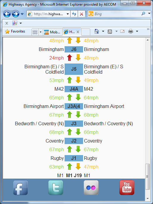
The Highways Agency in England has a mobile internet site. It enables users to drill down through a series of menu options to see the current traffic situation and live incidents. It also enables a view of motorway traffic flow by means of colour-coded arrows which show current speeds between junctions. (See figure below.)
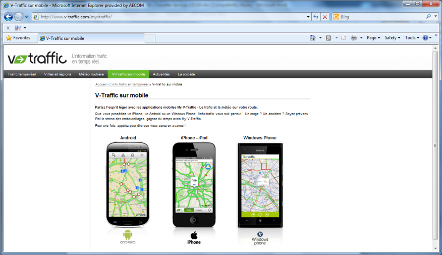
V-Traffic in France provides a sereis of Apps for traffic information. (See figure below). Separate Apps are available for the most popular mobile operating systems (Apple's iOS, Google's Android and Microsoft's Windows Phone).
The key elements to consider in Traffic and Travel information app or mobile website must be:
Human interface design is critical in such applications and care must be taken to consider the menu structure to allow access to salient information as easily as possible. (See User Centred Design )
Multi-modal journey planning is also available via mobile apps and websites and increasingly applications that provide real time updates while en-route are found.
A good example is the Guardian Angel service provided in Münster Germany.
Mobile applications for Iphone, Android and Windows phone are provided and the application enables the user to plan their journey which seamlessly includes real time updates of public transport services. If service disruptions occur on route then the application will replan the trip on the fly and advise the user of revised service connections.
When specifying mobile internet sites and applications it is vital to ensure the mobile site(s) or application will operate on phones or tablet computers of the target audience. The most popular operating systems currently in use are:
Web Accessibility Standards for users with a disability should be considered in the design stage.
Many public transport operators now offer Wi-Fi internet access on their services. In addition, mobile coverage continues to improve across both urban and rural locations.
So-called “Big Data” has opened up a whole world of information which can be accessed on the move. A large number of service providers (such as Transport for London in the UK) provide access to their real-time data for applications and websites so that this may be utilised in a variety of methods. Google Transit and CityMapper use this data to provide an integrated service covering all aspects of a cities transport. Delays, incidents and other problems can be instantly reported and changes to pre-planned routes or an alternative, unaffected route can be suggested to the user.
However, there are also sources of data open to those without smartphones. A range of text services and .mobi sites enable all users to access some level of current real-time information on the running of the network, including such data as expected arrival time of buses, known delays to the network and roadworks or vehicles accidents which may cause problems for public transport and motorists alike.
Other applications or apps available utilising such data are numerous and offer a range of services for public transport users. One such example is Moovit, an Israel-based application company which has provided a system enabling users to report on the level of crowding on public transport services, in addition to other factors such as the cleanliness, comfort and (on a bus) the driver’s performance. Over the long-term, using these reports, a picture of which services are busiest (and should be avoided by the space-conscious commuter if possible) is built up and factored in. San Francisco’s BART system and the Netherlands’ Rail Network are utilising similar applications, with the Dutch using historic loading data to indicate the level of over-crowding on some trains.